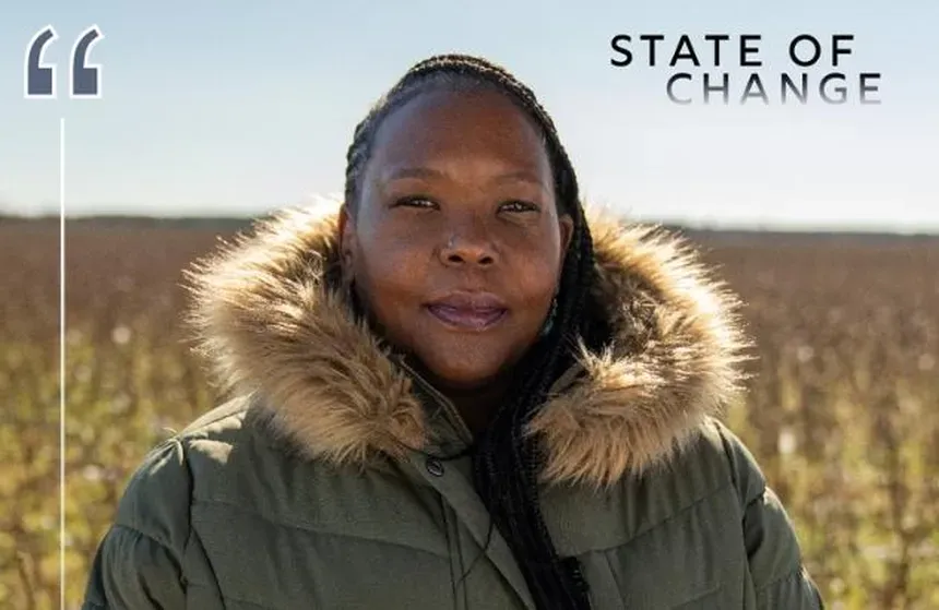
The Potential of Pocosin Peatlands’ Carbon Storage
Clip: Special | 8m 25sVideo has Closed Captions
Trek into the coastal peatlands and learn how these unique landscapes store carbon.
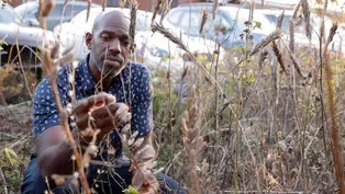
The Pocosin peatlands of North Carolina’s coast can store a huge amount of carbon in their spongey, highly organic soils. But when peatlands are ditched and drained, that carbon storage potential is lost and they’re vulnerable to fire. Learn how returning water to these ecosystems could have a huge impact on the amount of carbon dioxide in our atmosphere.
Problems with Closed Captions? Closed Captioning Feedback
Problems with Closed Captions? Closed Captioning Feedback
State of Change is a local public television program presented by PBS NC
State of Change is part of the Pulitzer Center’s Connected Coastlines reporting initiative. For more information, go to https://pulitzercenter.org/connected-coastlines.
The Potential of Pocosin Peatlands’ Carbon Storage
Clip: Special | 8m 25sVideo has Closed Captions
The Pocosin peatlands of North Carolina’s coast can store a huge amount of carbon in their spongey, highly organic soils. But when peatlands are ditched and drained, that carbon storage potential is lost and they’re vulnerable to fire. Learn how returning water to these ecosystems could have a huge impact on the amount of carbon dioxide in our atmosphere.
Problems with Closed Captions? Closed Captioning Feedback
How to Watch State of Change
State of Change is available to stream on pbs.org and the free PBS App, available on iPhone, Apple TV, Android TV, Android smartphones, Amazon Fire TV, Amazon Fire Tablet, Roku, Samsung Smart TV, and Vizio.
Explore More from State of Change
Hear from North Carolinians about climate change effects & innovative solutions across the state.- Peat is really just decayed, partially-decayed, plant material.
So this is the leaf litter.
This is what makes the peat.
It doesn't decay very fast.
If you break the leaves, it's very aromatic.
This is very unpalatable.
For the microbes, it's very difficult to break down; the difference between having a candy bar, or trying to eat a piece of wood.
So at the end of a year, you'll still have 50% of this material, whereas in a typical forest, all of this would decompose.
- People don't realize there's more carbon stored in the peat lands of the world than there are all the forests.
If you look at a typical forest soil, it's 1 or 2%.
Peat is basically 80 to 90% organic matter.
That's why they're so great at storing carbon.
To get to this goal of zero carbon emissions, we have to keep reducing this amount of carbon dioxide release.
If you just let these areas lie fallow and decompose, it can equal up to 2.5% of our annual goal of reducing carbon emissions for the entire United States.
It's an enormous amount.
If only 25% of the drain peat lands in Virginia, North Carolina, South Carolina, and Georgia, caught on fire in one year, you could equal at 18% of our annual U.S. goal of carbon dioxide reduction.
So we're trying to keep as much carbon in the system as we can, and wetlands are a natural sequester of carbon.
- [Sara] We are in Eastern North Carolina in the Albemarle-Pamlico Watershed.
We're passing by the farmland to the south, and then right up here to the east of here is the National Wildlife Refuge starting up.
Pocosin Lakes itself is 110,000 acres of primarily wetlands.
You will hear folks refer to peat lands elsewhere but Pocosin is specific to this area because of the Native Americans that called them that - [Eric] You might think from this perspective that we're just looking at an absolutely flat landscape but that's really not the case.
- They're domed, bogs are domed and essentially don't have streams.
They just basically get their water source from the rain.
- [Eric] What's interesting about these Pocosin wetland systems is they are not chronically inundated or flooded.
The groundwater level is actually below the soil surface which is a normal thing.
The water level is such that it's saturating that peat underground but it's not ponding and pooling.
- We get a lot of questions like, so where's the wetlands?
But that, that's all around us.
Actually, this, the wetness is in the soil.
- [Curtis] This is an area we've been working for over 10 years.
This is probably some of the deeper peat here.
We could have up to eight to 10, 10 feet of peat.
The south has 20% of the peatlands in the United States, which people can't believe, but we do.
- So this is a instrument that basically you put in the hole.
Oh, that's good.
That's encouraging.
And you turn it 180 degrees and this paddle basically cuts a a piece of peat and we pull it back out of the hole.
Lift with the knees, there we go.
And we can keep track of how far we are from the surface and get this vertical profile of information about how the peat has changed over time.
Let's see what we've got, feels good.
So there, yeah, that's a good one.
- [Curtis] That's a beautiful core that - [Neal] Yeah - [Curtis] that core property represents at the base probably about 2000 to 3000 years in age.
- [Sara] These landscapes started to change in the sixties and seventies when there was ditching and draining primarily with the hopes of them being converted to agricultural fields.
The vast majority of the Pocosin Lakes portion of the refuge was drained around that time.
I think one of the things that's unique about these habitats is they're fire dependent.
Most people think of forest fires and wildfires starting in the canopy or the above ground layer but peat lands, actually, the soil itself is combustible.
- [Eric] What you have to think about is that in a natural state the majority of the time that that underlying soil is going to be at least, you know partially saturated and it's gonna be wet.
So a fire is, fire would move through these systems and burn the vegetation but it wouldn't actually get down into the soil and burn.
But when these soils are, you know, very, very dry so during natural drought periods or in a ditch situation where the water levels being artificially dropped lower than it would be naturally, it it makes them very, very vulnerable to catching on fire.
In 2008, for example, there was a a wildfire that lasted for several months.
- [Curtis] 2008, we had a fire that was so big you could smell the smoke in Durham, and it went all the way to Asheville.
We burned off 9.9 teragrams of carbon.
That's the amount of carbon dioxide released by 2.5 million cars driving 12,000 miles in a year in one fire.
- [Sara] The fire will move underground and we've seen, you know repeated fires out here that will burn away feet of soil four to five feet in the most intensely burned areas.
- A thousand years of accumulation could go up in smoke - Yeah, in an hour.
- in literally an hour.
- Yeah.
- If it's drained.
- If we put water back in the soil we provide for the habitat but we're also making the landscape more resilient to the effects of catastrophic wildfire.
The most altered part of the refuge has a ditch network every mile by half mile.
And then even within that every 320 feet there are v ditches.
It was purchased by the Conservation Fund and donated to the Fish and Wildlife Service in 1990.
So one of the first things that managers at that time did was to essentially develop the plan for how to fix the drainage network on the landscape.
- So the main way that we achieve hydrologic restoration or rewetting, these Pocosin wetlands is by installing flashboard riser water control structures.
And essentially it's a culvert pipe and you're able to control what the water level is in the ditch that's just uphill of that structure.
So, across the front here is the riser pipe with three weir slots.
So the refuge management staff can put wooden boards down into those weirs up to the height that they would like the water to be ideally before it then would spill over the boards and continue down.
So, we stage these structures gradually up the slope of a Pocosin dome or the hill of this wetland about every one foot of elevation increase.
So we're very gradually stair-stepping the groundwater level back up this Pocosin dome.
We're rewetting with rainwater.
We're rewetting these soils from below.
From my perspective, the most important kind of next steps is doing this on private land.
If a private landowner were to own an area that was previously ditched and drained Pocosin wetland they could use the same sort of infrastructure that is being used at project sites all across the coastal plain here in North Carolina.
Re-wet their lands and then generate carbon credits that could be sold on the voluntary carbon market.
- It's a market-based approach to restorations.
These markets have emerged looking at ways that folks can invest in essentially a verified carbon offset something to offset greenhouse gas pollution and measuring it's important because you wanna make sure that it's truly carbon that otherwise wouldn't have been sequestered or stored in the land.
And so these measurement methodologies and approaches are just a way for anyone who invests in that market to know that it was carbon that actually is moving the needle to address the problem of greenhouse gas emissions in a meaningful way.
- [Curtis] We did these studies over a period of 10 years and it's an amazing amount of carbon that we can store in these systems.
- If we don't manage these lands the right way we'll never get it back because of how slowly they formed over time.
We really have to steward them, right.
All of our work that we're trying to do internationally to address climate, there's no way we get there without our peat lands functioning.
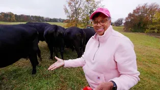
Fighting Saltwater Intrusion in the Blacklands
Video has Closed Captions
Productive farmland in NC’s Tidewater region needs protection from rising sea levels. (9m 2s)
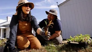
Planting Piedmont Grasslands Helps Fight Climate Change
Video has Closed Captions
Learn how planting native grassland plants mimics historical landscapes and stores carbon. (8m 34s)
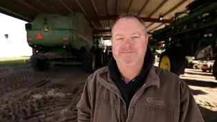
Thinking Outside the Box with No-Till Farming
Video has Closed Captions
Farmers and researchers in Reidsville see the positive impacts of no-till agriculture. (8m 22s)
Video has Closed Captions
North Carolinians are using natural solutions to respond to our changing climate. (59s)
Providing Support for PBS.org
Learn Moreabout PBS online sponsorship


State of Change is a local public television program presented by PBS NC
State of Change is part of the Pulitzer Center’s Connected Coastlines reporting initiative. For more information, go to https://pulitzercenter.org/connected-coastlines.